Research Topic
Can AI-driven analysis of agricultural drone imagery help farmers make more precise, targeted decisions about pest management, irrigation, soil moisture, crop disease, and harvest yield?
Project Summary
The Agricultural Challenge
Modern agriculture increasingly depends on precise, data-driven decisions across large and variable farmlands. Rather than relying only on whole-field treatments, the ICICLE project demonstrates how AI-enabled analysis of drone and sensor data can support more targeted agricultural management.
Modern agriculture faces the challenge of making precise, data-driven decisions across vast farmlands. Traditional approaches often apply uniform treatments—pesticides, irrigation, fertilizers—across entire fields, wasting resources when only specific areas need attention. The ICICLE project demonstrates how AI-driven analysis of drone imagery can enable precision agriculture through accessible computational workflows.
Data Collection and Field Operations
The ICICLE team's agricultural drones capture thousands of high-resolution images during single flights, generating multi-gigabyte datasets per mission. These images, combined with sensor data measuring temperature differences that indicate crop stress and disease, provide comprehensive field monitoring capabilities.
Data Transfer and Management
Raw imagery and sensor data are transferred from field collection systems to Ohio Supercomputer Center (OSC) resources using Globus. This automated data transfer system handles the large datasets reliably without requiring manual intervention, enabling continuous data flow from multiple drone flights across different agricultural sites.
Computational Access and Workflow Management
The computational analysis happens through ACCESS OnDemand, OSC's web-based portal that provides intuitive access to high-performance computing resources without requiring command-line expertise. Agricultural researchers can launch interactive sessions to examine drone imagery, submit batch jobs for large-scale AI model training, and monitor processing progress through a standard web browser. This accessibility proves crucial for interdisciplinary teams that include agricultural specialists without traditional HPC backgrounds.
AI-Driven Analysis Pipeline
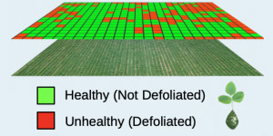
The processing leverages OSC's computational resources to run AI algorithms that create infrared heat maps from drone imagery, enabling identification of crop stress, disease detection, and growth stage classification. The team uses performance benchmarking approaches to optimize data processing pipelines for the high-volume image analysis required for real-time farm management decisions.
Real-Time Decision Support
The combination of Globus for seamless data movement and ACCESS OnDemand for accessible computing enables farmers and crop consultants to receive timely insights about soil moisture, crop disease, and growth patterns. This infrastructure transforms what would traditionally require weeks of manual analysis into rapid, data-driven decision making that can adapt to field conditions in real time.
Scalable Applications
The workflow extends beyond individual farm applications—the same cyberinfrastructure approach supports crop consultants serving multiple farms and can be adapted for environmental monitoring and urban planning applications. By making AI accessible through user-friendly interfaces and robust data management, ICICLE demonstrates how modern computing infrastructure can bridge the gap between advanced computational methods and practical agricultural needs.